Many informations about COVID-19, CORONAVIRUS, how will it spread into population
in many countries, actual COVID-19, CORONAVIRUS GRAPHS, also Perspectives, forecasts, outlooks for the future, epidemic and pandemic prognosis and actual
>>>>>> COVID-19, CORONAVIRUS PREDICTIONS <<<<<<
COVID-19, CORONAVIRUS links to GRAPHS day by day
COVID-19, CORONAVIRUS links to PREDICTIONS day by day
Other interesting COVID-19, CORONAVIRUS summary links and reference pages

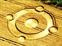
Crop circles - England

Crop circle archive - England 2012 (2011, 2010-09, 2008-06, 2005-04, 2003-94)
2012.04.18 West Overton Hill crop circle, GPS 51.399225 -1.820210
2012.04.28 Yarnbury Castle crop circle, GPS 51.158004 -1.947400
2012.05.12 Water Eaton crop circle, GPS 51.636231 -1.799753
2012.05.13 Hannington crop circle, GPS 51.635018 -1.783682
2012.05.19 Uffington crop circle, GPS 51.583987 -1.568685
2012.06.02 Manton crop circle, GPS 51.407218 -1.758015
2012.06.09 Woodborough Hill crop circle, GPS 51.349383 -1.831252
2012.06.12 Silbury Hill crop circle, GPS 51.412904 -1.861295
2012.06.13 Silbury Hill crop circle, GPS 51.410727 -1.865106
2012.06.17 Frome crop circle, GPS 51.243456 -2.288508
2012.06.17 Telford crop circle, GPS 52.665854 -2.533093
2012.06.20 Golden Ball Hill crop circle, GPS 51.369785 -1.821347
2012.06.20 Oare crop circle, GPS 51.371293 -1.777156
2012.06.20 Telford crop circle, GPS 52.662439 -2.516057
2012.06.25 Adams Grave crop circle, GPS 51.365144 -1.846539
2012.06.25 Cherhill crop circle, GPS 51.426096 -1.936453
2012.06.26 Beckhampton crop circle, GPS 51.424796 -1.900557
2012.06.26 Stanton St Bernard crop circle, GPS 51.365009 -1.865888
2012.06.29 Stanton St Bernard crop circle, GPS 51.357999 -1.860564
2012.07.01 Avebury crop circle, GPS 51.421208 -1.851309
2012.07.01 Telford 1 crop circle, GPS 52.677849 -2.498674
2012.07.01 Chilcomb Down crop circle, GPS 51.058472 -1.258874
2012.07.01,21 Foxhill crop circle, GPS 51.526023 -1.673257
2012.07.05 Westwoods crop circle, GPS 51.393604 -1.808456
2012.07.09 Picked Hill crop circle, GPS 51.348792 -1.819201
2012.07.11 Corley crop circle, GPS 52.463013 -1.553080
2012.07.12 Etchilhampton Hill crop circle, GPS 51.340935 -1.951066
2012.07.16 Stanton St Bernard crop circle, GPS 51.358835 -1.860664
2012.07.17 Yatesbury crop circle, GPS 51.436943 -1.927957
2012.07.21 Telford crop circle, GPS 52.678795 -2.554533
2012.07.21 Telford crop circle, GPS 52.678795 -2.554182
2012.07.22 Aldbourne crop circle, GPS 51.484502 -1.625874
2012.07.23 Longwood Warren crop circle, GPS 51.041394 -1.230940
2012.07.24 Allington crop circle, GPS 51.373895 -1.895555
2012.07.24 Bishops Cannings Down crop circle, GPS 51.396853 -1.928215
2012.07.25 Hinton Parva crop circle, GPS 51.531769 -1.657884
2012.07.25 Windmill Hill crop circle, GPS 51.432562 -1.871350
2012.07.26 Olivers Castle crop circle, GPS 51.382589 -1.990147
2012.07.26 West Overton Hill crop circle, GPS 51.398237 -1.813616
2012.07.28 Etchilhampton Hill crop circle, GPS 51.349046 -1.957100
2012.07.28 Hannington crop circle, GPS 51.628794 -1.746702
2012.07.29 Allington crop circle, GPS 51.373034 -1.902861
2012.07.29 Ogbourne St George crop circle, GPS 51.469981 -1.765656
2012.07.29 Owlesbury crop circle, GPS 51.022209 -1.263539
2012.07.31 Windmill Hill crop circle, GPS 51.438008 -1.872674
2012.08.01 Avebury crop circle, GPS 51.431103 -1.850309
2012.08.02 Martinsell Hill crop circle, GPS 51.380176 -1.729049
2012.08.04 Coventry crop circle, GPS 52.427849 -1.588974
2012.08.05 Milk Hill crop circle, GPS 51.371408 -1.866359
2012.08.05 Owslebury crop circle, GPS 51.014259 -1.248778
2012.08.08 Roundway crop circle, GPS 51.373939 -1.978523
2012.08.09 Cheesefoot Head crop circle, GPS 51.046668 -1.244090
2012.08.09 Cheesefoot Head crop circle, GPS 51.046000 -1.242720
2012.08.11 Bishops Cannings crop circle, GPS 51.383000 -1.956939
2012.08.11 Malmesbury crop circle, GPS 51.588427 -2.065260
2012.08.12 Devils Den crop circle, GPS 51.425249 -1.783724
2012.08.14 Uffington crop circle, GPS 51.581599 -1.568416
2012.08.15 Leamington Spa crop circle, GPS 52.327829 -1.454541
2012.08.18 Leamington Spa crop circle, GPS 52.269487 -1.476190
2012.08.19 Furze Hill crop circle, GPS 51.392620 -1.825634
2012.08.20 Woodborough Hill crop circle, GPS 51.351320 -1.826404
2012.08.21 Barnsley crop circle, GPS 53.544559 -1.542050
2012.08.21 Furze Hill crop circle, GPS 51.384571 -1.823612
2012.08.21 Hackpen Hill crop circle, GPS 51.472769 -1.812595
2012.08.21 Hackpen Hill crop circle, GPS 51.469310 -1.813790
2012.08.23 Savernake Forest crop circle, GPS 51.416759 -1.670905
2012.08.26 Hackpen Hill crop circle, GPS 51.477098 -1.820147
2012.08.30 All Cannings crop circle, GPS 51.359906 -1.892636
2012.09.05 Ridgeway crop circle, GPS 51.418585 -1.829223
2012.09.07 Rochford crop circle, GPS 51.568483 0.723184
Long quotations (considerably more than only a few sentences) from domain cropcirclesonline.com also translated to any language, would be better publish anywhere with author's permission. Thanks.
Also copyrighted photographs ©cropcirclesonline.com ©quick spigots
Citations allowed, certainly. Name source, please. Also link where possible, thx.
Contact cropcirclesonline@gmail.com or lightningsymbols(at)hotmail.com
